Pueblo of Santa Ana – Tamaya
The Tamaya Indian Reservation is located in North-Central New Mexico, along the Rio Grande. The reservation encompasses approximately 79,000 acres of land in the county of Sandoval. The southern border of the reservation is the town of Bernalillo. Interstate 25 runs through the east of the Pueblo. Tamaya is made up of three villages: Rebahene, Ranchitos and Chicale.
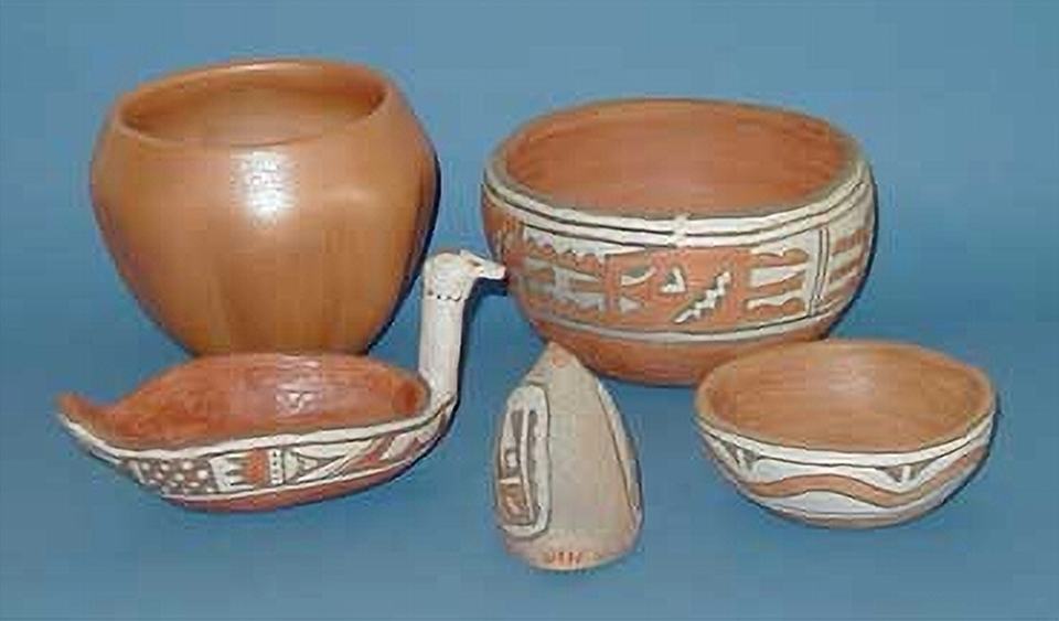
The potters of Santa Ana often return to their old pueblo on the north bank of the Jémez River to collect red clay, which they temper with sand from the river. They slip their pots with white or buff, and paint them with simple old designs, mostly geometrics or abstract images of clouds, flowers, and sometimes turkey eyes. Santa Ana potters use a lot of red paint in decorating their pots, with or without the black outline customary at other pueblos. They paint the bases of their pots red as well as the insides of the rims, which they encircle with a thin band that often has a line break. They paint thick lines and strong shapes on the bulging part of the pot between the two.
The original pueblo, located at approximately 5,400 feet above sea level, lies against a craggy mesa wall on the north bank of Jemez River. The site provided both protection and seclusion. Travelers to the area historically tended to follow the north-south trade route along the Rio Grande or headed east and west without making contact, making Santa Ana one of the least visited of the New Mexico pueblos.
For Directions, information about hours, admission fees and programs go HERE